Thursday, September 11, 2025

Emigrant Wilderness: Granite Dome Loop (2025)

Dates: August 30 - September 1, 2025

I spent the Labor Day weekend backpacking with some new friends out in the Emigrant Wilderness, doing a 38 mile clockwise loop around Granite Dome, starting and ending at Kennedy Meadows (AllTrails). This was my first time in Emigrant Wilderness and the landscapes did not disappoint. With the self-issue, no limit permits, I will definitely be back here.

Day 1: Kennedy Meadows to Sheep Camp (9.6 miles, +3000 ft elevation gain)

We left the Bay Area around 5:30 AM and got to the trailhead just past 9 AM after a quick stop at the Summit Ranger station to pick up a permit. Most of the first day was uphill, passing by the Relief Reservoir and heading up the canyon along the Huckleberry Trail to Sheep Camp. We got a taste of all the classic Sierra views that would continue into the next two days: lush forests, hints of meadows, and the never-ending granite walls and staircases. We had sunny skies with small patches of clouds throughout the entire holiday weekend.


Hiking past the Relief Reservoir.

Sheep Camp was a nice place to set up for the night; there were several other groups there but it was not too crowded. Water access here was no problem with the creek running right through the middle.


Wednesday, August 13, 2025

Thousand Island Lake Backpacking (2025)

Dates: August 2-3, 2025

I recently took a few friends on their first ever backpacking trip to Thousand Island Lake, having heard so much about the lake and the views there.

I took the River Trail directly to the lake from Agnew Meadows, and returned the second day via the JMT passing Emerald, Ruby, and Garnet Lake before taking the Garnet Lake cutoff back to the river trail (didn’t get around to visiting Shadow Lake unfortunately). We had perfect weather the entire weekend, without a single cloud in the sky.

Day 1: Agnew Meadows to Thousand Island Lake via River Trail (9 miles, +2000 ft elevation gain)

We had to take the shuttle from the Mammoth Adventure center to the first stop, Agnew Meadows. The shuttle is very convenient to take on the way in; just buy a ticket at the Adventure center and get on the shuttle, which runs every 20 minutes for most of the day during the weekends.

Water sources were readily available along the River Trail and we didn’t need to carry more than a liter at a time. The elevation gain was pretty well distributed along the whole distance, and there was no part that was significantly difficult. The trail was a little sandy for the first few miles, which was a little annoying to walk along since each step kicked up a good amount of dust. We had regular breaks along the trail, taking in the sights and eating our snacks. When we finally crested the hill and turned toward the outlet of the Thousand Island Lake, we were greeted with the view of Banner Peak rising into view over the trees. It took us some time to find a good place to camp along the shore since we didn’t want to be too far from the water and many places were marked for restoration. There were a decent number of people camped here for the night, which is not surprising given its popularity and intersection with the JMT and PCT. (Turns out more sandy sites were higher up along the shore than I expected.) For dinner, we brought along burritos that we bought in Mammoth right before we got on the shuttle. Not the greatest burrito in the world, but it was still slightly warm and delicious after a long hike.


Approaching the lake.

The view of Banner Peak and the Thousand Island Lake exceeded my expectations. The changing sunlight during sunset and sunrise created a beautiful warm glow on the peak that faded into the night; however, the night was not any more incredible under the light of the stars and moon. I woke up several times at night to capture photos of the Milky Way rising over Banner Peak, reflected in the still water of the night. It was nearly silent after the wind died down past sunset, with only the occasional blip of noise from nearby animals.

Perfect reflection.

Monday, July 14, 2025

Yosemite: Grand Canyon of the Tuolumne Backpacking (2025)

Dates: July 4-6, 2025

Moving upstream from the Hetch Hetchy reservoir where I was just a few months earlier, I spent the long 4th of July Weekend back in Yosemite backpacking the Grand Canyon of the Tuolumne. I invited a friend, and another backpacker I met online tagged along. We left Thursday night to avoid the July 4th traffic and stayed a night in the White Wolf backpacker’s campground. We got there just past midnight and quickly set up wherever we could find space and got to sleep. The weather was perfect, with no wind and clear skies, so I cowboy camped under the stars to avoid having to set up my tent.

Looking straight up at the backpacker's campground.

Day 1: White Wolf to Pate Valley (10.8 miles, +400 ft, -4,000 ft)

After spending the night in the backpacker’s campground, we drove to the Tuolumne Meadows wilderness center and got our permits. A climber who was staying at the White Wolf campground was also looking to get to Tuolumne Meadows and I gave him a ride since we were headed that way anyways.

With permit in hand, we took YARTs back to White Wolf to start our journey. Another couple (hi Thomas and Emily!) was backpacking the same route and took the same YARTs trip as us. We would continue to pass each other back and forth over the next three days.

The first part of the trail was easy going, starting off as a gravel fire road and becoming a normal backcountry trail that gently sloped downwards towards Harden Lake. From here, it became a series of steep switchbacks that descended quickly into the valley, a true test of your knees and ankles. The trail was in relatively good condition, just a little overgrown at first. Halfway down there is a clearing with a good view point of Hetch Hetchy from the back, a familiar but different view from the ones I had when hiking the Hetch Hetchy loop back in May. There were pretty much no mosquitoes along this segment of the trail, and the air kept getting warmer as we descended. We set up camp just past the bridges that cross the river in Pate Valley.

Hello Hetch Hetchy again!

Done with all the switchbacks in Pate Valley.


Day 2: Pate Valley to Waterwheel Falls (12 miles, +3,300 ft)

We had an easy-going morning before heading out for the hardest day of the trip. We meandered through the foliage of the valley alongside the river before climbing around Muir Gorge. We took a long break at the Register Creek crossing, dunking ourselves in the refreshing pool at the base of the waterfall. Many other hikers were stopped here doing the same, filtering water, or just enjoying lunch at the falls.


We had plenty of the time in the long summer day to finish these miles and were in no rush to get to camp. We took another long break right before Return Creek and Waterwheel Falls, dipping into the water again and just chilling on the granite slab by the river.

We camped right above Waterwheel Falls after a little bushwacking to the river shore where we found an existing campsite. The mosquito pressure was mild around here, and we could stay outside without too many issues.

Waterwheel Falls.

Overlooking the falls.

Day 3: Waterwheel Falls to Tuolumne Meadows (10 miles, +1,900 ft)

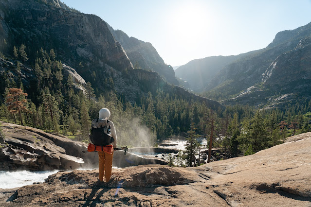
Waterwheel Falls from yesterday was just the warmup for the main event on our last day. We would be passing more multiple major waterfalls on our climb out of the canyon into Tuolumne Meadows. The views just kept getting better as we got further along the trail, with each waterfall, Le Conte, California, and White Cascade (not to mention all the smaller ones on the side) impressive in their own way. The mosquitoes were the worst on the way to and through Glen Aulin, but nothing that bad.

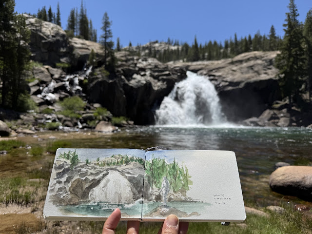
With pretty much all the climbing done once we reached Glen Aulin, we took a long break at the Glen Aulin High Sierra Camp in front of the White Cascade. I did another quick painting there after soaking my feet in the cold water. The mosquitoes had also mostly dissipated from here on out.


Hachiware with a new buddy.

The remaining flat trail through Tuolumne Meadows was just as scenic, and we took one last break on a wide open expanse of flat granite that the river meandered through. Lying bare against the warm rock after dipping into the water was incredibly soothing, and I could have easily fallen asleep there. Alas, I didn’t want to get sunburnt, wanted to eat some fresh food, and also wanted to get back home at a reasonable time, so we got going. After a few quick stops at some of the popular points in the meadows and along Tioga Road, we drove home with another successful backpacking trip done. Thanks again to Arthur and Tommy for the company on this trip. I highly recommend this trail and in this direction; you won’t be disappointed by the views. 


Friday, June 20, 2025

Point Reyes: Coast Camp Backpacking (2022)

I've had this footage from this 2022 backpacking trip just sitting around for a long time; better to just export it as-is before it is lost to time.

My second backpacking trip ever, and my first one solo. A quick and easy trip to get warmed back up into backpacking. 


Dates: July 18-19th, 2022

Thursday, June 5, 2025

Yosemite: Hetch Hetchy Loop Backpacking (2025)

Dates: May 15-17, 2025

Three days and two nights on this classic Yosemite loop around the Hetch Hetchy Valley. I originally didn't intend to have any plans until later into the summer, but I was invited to go on this trip by a coworker. I was originally hesitant on going due to a foot injury I was still recovering from (post-tibial tendonitis from some overuse over a month before), but it was feeling much better, so I chose to go. We went clockwise starting from the dam, with the first night at Lake Vernon and the second night at Rancheria Falls. The weather forecast was partly cloudy with a chance of rain on the last day, perfect weather for the trip. Mid-May was a great time for the trip: before all the mosquitos spawn, before the heat coming later in the summer (flashback to my trip last year in July where it was cooking), and just after most of the snow had melted.

Day 1: O'Shaughnessy Dam to Lake Vernon (10.5 miles, 3,280 ft elevation gain)

After driving from the Bay Area in the early morning, we started our hike around 10AM after meeting up with the others at the Oak Flat entrance and driving to the O'Shaughnessy Dam. We had a steady climb out of the valley; not too hot and not too exposed. Past the junction for Miguel Meadows we ran into a few small snow patches and muddy bits of trail but otherwise the trail was dry.

We got to Lake Vernon around 4:30PM and found a nice flat area next to the north side of the lake to set up camp.


Sierra newt in Lake Vernon. I saw at least six all nearby.

The water in Lake Vernon was freezing: colder than I think any other alpine lake I had been in before. I could only keep my feet in there for 20 seconds before it got rather painful. It was a nice ice bath for my feet though, keeping them ready for the next day.

Friday, March 14, 2025

Travel Sketching

Over the last few trips I've gone on, I've taken up sketching whenever I can get a chance. More than just an opportunity to practice and take up the mantra of "always keep drawing all the time," I've found that sketching is a great way to really consider the details of what I'm seeing and to better remember the moment. It's also just fun. Below are photos of my sketchbook from my most recent trip, a trip to the northern part of Japan. The first five spreads are from a bigger watercolor sketchbook and the rest are from a pocket-sized sketchbook.


Below are some more excerpts of sketches from previous trips: